
Directions
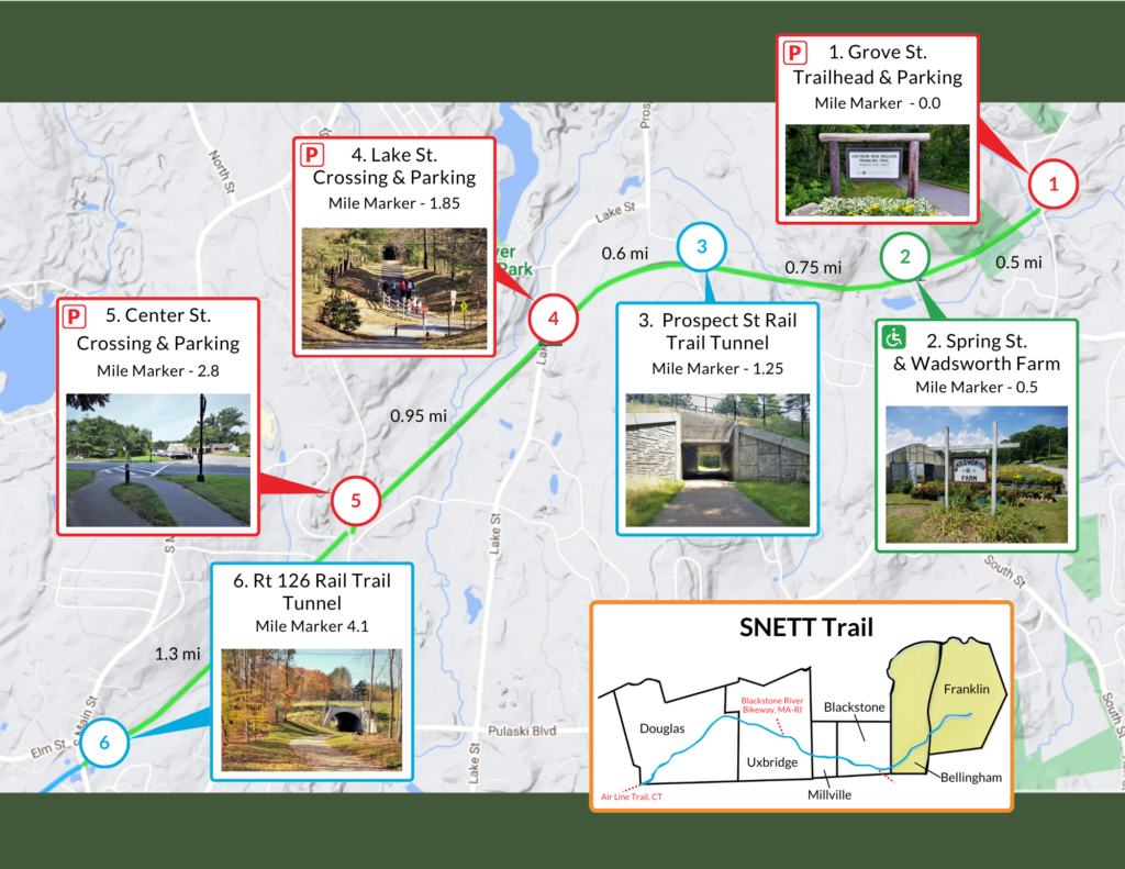
The Southern New England Trunkline Trail (SNETT) begins on Grove Street in Franklin, MA and travels 22 miles through the towns of Bellingham, Blackstone, Millville, Uxbridge and Douglas into Thompson CT. Below are directions to the trail head in Franklin (parking available).
From South:
I-495 North to exit 16. Take a left at the end of the ramp. Travel straight through 2 traffic lights aprox 1 mile on King Street and continue onto Washington Street for .7 miles through 1 traffic light. Take a right onto Grove Street. Rail Trail parking will be .4 miles on your right. Trail is on left side of street.
From North:
I-495 South to exit 16. Take a right at the end of the ramp. Travel straight through 2 traffic lights aprox 1 mile on King Street and continue onto Washington Street for .7 miles through 1 traffic light. Take a right onto Grove Street. Rail trail parking will be .4 miles on your right. Trail is on left side of street.